On September 28, a tropical disturbance formed in the southern Caribbean sea, and began to track slowly northwestward. Over the next couple of days, the trough associated with the disturbance became much better defined, but the convection associated with the system remained disorganized. Convection increased markedly around the deepening low pressure center during the days of October 1 and 2 as the system approached the Gulf of Mexico, but aircraft investigation did not discover a well-defined center of circulation. The system caused very heavy rainfall and gusty winds in eastern Cuba as it passed by, and on October 3, as the system entered the southeastern Gulf of Mexico, a defined center appeared. The system was upgraded to Tropical Storm Karen. Due to the exceptionally high winds found east of the center, the initial intensity of the cyclone was already 60 mph!
Though by the measured wind speeds, Karen was a strong tropical storm, it did not appear as such. Strong upper-level winds constantly exposed the center overnight and into October 4 as the storm moved into the central Gulf. Over the next day, Karen continued to struggle north-northwestward, weakening gradually as wind shear displaced thunderstorm activity to the east of the center. By the morning of October 5, the system had become a minimal tropical storm and was approaching the Gulf Coast.
Later that day, Karen paused again, becoming nearly stationary south of the Louisiana coastline due to a ridge situated to its east. Atmospheric conditions continued to worsen that evening, and it became evident that the cyclone's circulation was slowly deteriorating. It was downgraded to a tropical depression overnight, and dissipated early on September 6, never having made landfall. Some of the moisture associated with Karen moved northward along a frontal boundary over the next day and caused enhanced rainfall up and down the east coast.
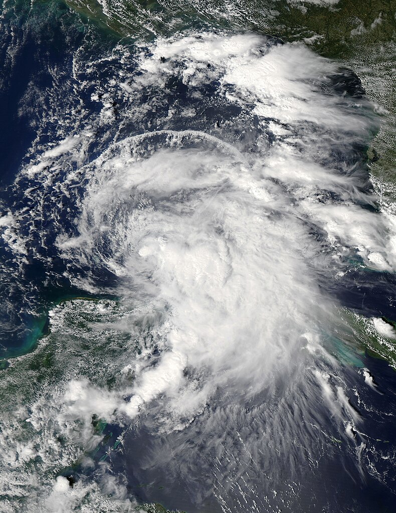
Even at peak intensity, when the cyclone was producing 65 mph winds, Karen did not exhibit much convective organization.

Probably due to its shallow circulation, Karen's forward motion diminished as it entered the northern Gulf of Mexico and the system was ripped apart by wind shear.
No comments:
Post a Comment